

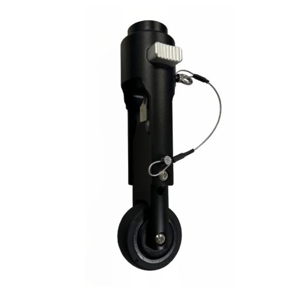
Versatile Use: Ideal for various applications including topographic surveys, volume surveys, site preparation, and GIS projects. Enhanced Stability: The wheel (optional) allows you to effortlessly carry the weight of all your GPS equipment while maintaining stability. Smooth Ride: Equipped with a non-pneumatic, microcellular wheel (optional), it provides a smooth and maintenance-free experience.
- Please enter your account to make a purchase
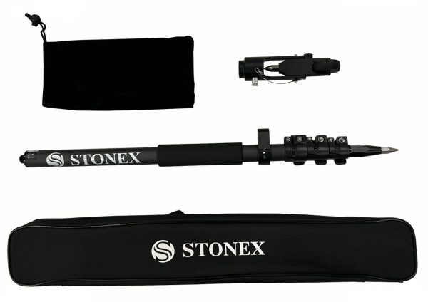
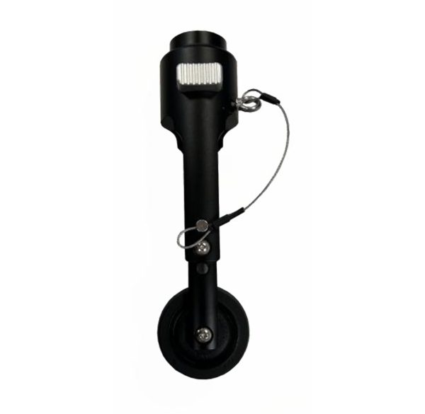
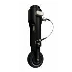
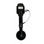
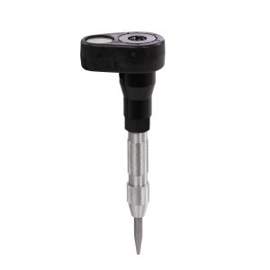
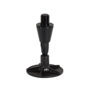
GNSS Pole with roller tip
In Stock
Highlights:
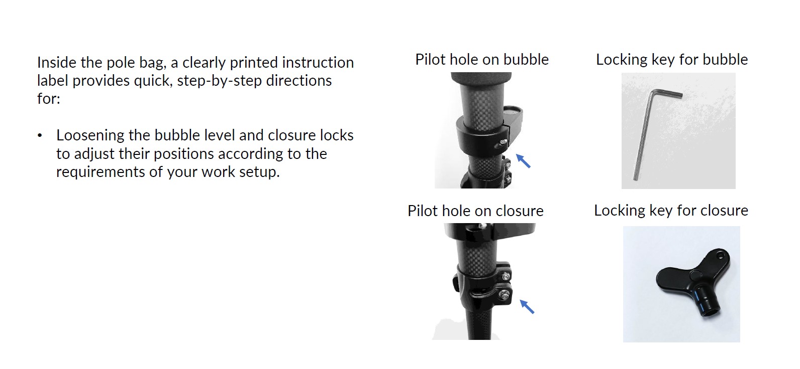
The wheel is an optional accessory for the new carbonium pole, length 1,80m (1,895m with the tip roller), composed of three sections and featuring secure closures.
Related products
ROD5N
Highlights:
Telescopic levelling rod made of light and durable aluminium; silk-screened with moisture-resistant inks. Max extension: 5 m
Prism Punch Marker (PN-1)
Highlights:
Mini prism pole with bubble level and integrated centre punch tip
Product number: 14047000
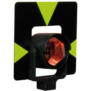
Prism Leica Style GPR
Highlights:
The universal prism made of impact-resistant polycarbonate with Leica spigot mount offers you uncompromising quality in terms of: Centring accuracy, range, service life and measuring precision.
Product number: 14100000
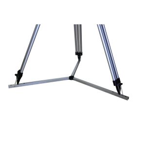
Three star for tripod as floor pad, 50 cm
Highlights:
The Dreistern, with a leg length of 50cm, for tripods is especially suitable for smooth surfaces. The Dreistern can simply be folded out and the tripod feet placed in the appropriate holes. The three-star prevents slipping and scratching of the surface on smooth floors.
Product number: 13929000
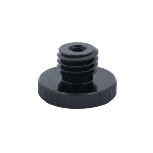
Reach RS3/RS2+ thread adapter
Highlights:
Thread adapter 1/4” female (photo tripod thread) to 5/8” male. Adapter height 6 mm.
Compatible with Reach RS3/RS2/RS2+.
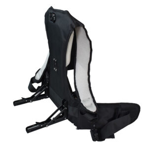
Frame backpack
Highlights:
Frame backpack for AlphaGEO 3D Slam Scanners
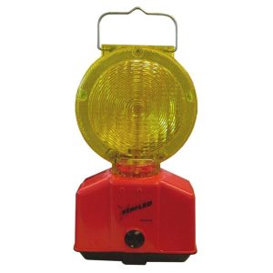
Warning light starLED
Highlights:
This double-sided high-power LED warning light with practical carrying eye and double battery compartment is ideal for tough construction site use. The battery can be changed conveniently and without completely dismantling the lamp. Thanks to the integrated twilight switch, it only lights up in the dark. With the help of the adapter supplied, the lamp can be easily attached to NESTLE warning pyramids. Switchable between flashing and steady light.
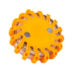
Warning light
Highlights:
Specifically designed for emergency situations, especially in the dark,
in the rain, fog and smoke.
The solid and robust construction (shock, vibration and water resistant),
it can withstand even the heaviest loads.
Nr. 19818000
Not approved for road traffic!
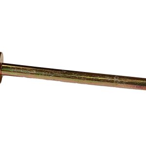
Tip, with unscrewable sand plate
Highlights:
Tip with removable sand plate for all Nestle carbon prism poles, DN 32 mm, with removable tip. Reliably prevents sinking into soft surfaces. The sand plate can no longer get lost.
Product number: 14956000