Utility survey is a type of survey used to determine the type and location of subsurface utility infrastructure in order to create a comprehensive map for the client.
A-GEO understands the critical role of surveying in utility projects. We offer utility-specific surveying equipment such as underground locators, pipe and cable locators, and GIS mapping tools. Our training programs cover utility surveying techniques and software for utility mapping and maintenance. Our consulting services assist utility companies in optimizing their infrastructure management and maintenance processes.
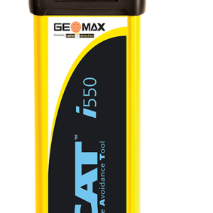
The EZiSYSTEM cable avoidance equipment makes locating buried cables and pipes easy and efficient. With an EZiSYSTEM i-Series locator, there is no need to manually adjust the sensitivity. With the unique Automatic Pinpointing feature users can simply hold the trigger and start locating.
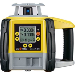
Capable of operating at a speed of 15 rps (rotations
per second), the Zone75 DG is a perfect fit for machine
guidance solutions. With a laser beam that is stable
over longer distances, it is especially suited for land
levelling and agriculture applications.
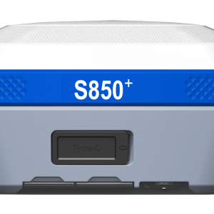
The Stonex S850
GNSS receiver is the ideal solution for any surveying
work in the field. The receiver’s advanced design gives the S850 excellent
signal tracking and interference resistance capabilities. The advantages of
portability and speed of operation make the S850 GNSS receiver
particularly suitable for field work in areas with complex terrain.
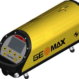
The various models of the Zeta125 Series give you the flexibility to choose a device that
perfectly fits your needs. With the outstanding grade range from -10% to 40%, the Zeta125 is
very versatile.
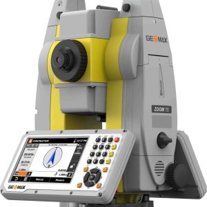
The GeoMax Zoom75 Series Robotic Total Station is packed with modern features to meet your surveying needs while remaining surprisingly affordable. This survey device is a smart choice for either construction professionals or surveying novices.
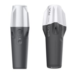
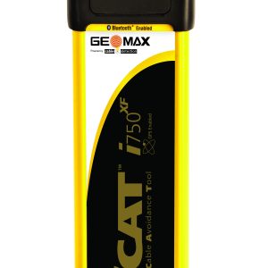
The EZiSYSTEM xf-Series utility locating and
tracing equipment makes locating buried utilities
easy and efficient. The xf-Series locators have
additional low frequencies enabling you to locate
and trace utilities over longer distances and
in congested environments.
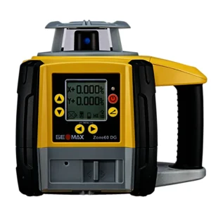
The Zone60 DG is a fully-automatic grade laser in
both axes, specifically designed for crews that require
dependability and accuracy on a daily basis. Digital
grades can be entered up to 15% slope making it
suitable for almost any construction site.
Save even more time by using this laser with the
ZRD105B laser receiver, which automatically catches and
monitors the laser’s beam.
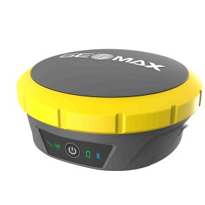
Become more productive and efficient with the Zenith60’s calibration-free tilt capability, making every
survey faster and more convenient. The antenna is resistant to magnetic interferences, so you can
enjoy the comfort of knowing you can trust your data.
Select options
This product has multiple variants. The options may be chosen on the product page
Get access to your Orders, Wishlist and Recommendations.
Signup
Your personal data will be used to support your experience throughout this website, to manage access to your account, and for other purposes described in our privacy policy.