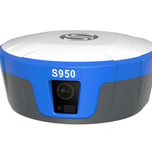
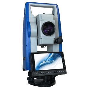
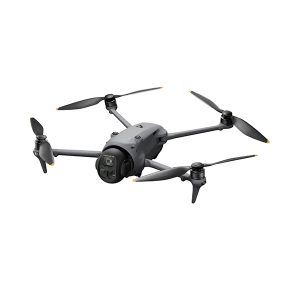
Latest Products
X200GO
The X200GO is the latest generation system based on the SLAM technology, capable of covering any customer need.
The range of up to 300 metres and a rotating head that maximises the coverage of the laser beam make it versatile for any environment. Equipped with 2 cameras and RTK receiver for real-time point cloud colouring and orientation.
The two cameras provide navigable and measurable panoramic cameras superimposed on the 3D model. The system allows for the survey of static scans in X-Whizz mode, automatically aligned to the SLAM survey.
Backpack, shoulders hook, car mount and holder for DJI M350 can complete the system.
DJI Flip
DJI Flip is DJI’s first drone equipped with a foldable full-coverage propeller guard.The guard features a carbon fiber support structure that is only 1/60 the weight of traditional Polycarbonate (PC) material while maintaining the same stiffness.
GPR111
Circular prism with holder and target plate.
MESA® 3 Rugged tablet
With best-in-class features including an ultra-rugged ergonomic design, sunlight-readable display, and all-day battery life, Mesa® Rugged Tablets provide the ultimate device for a variety of mobile data collection applications.
Our Services

Heavy Construction
For heavy construction projects, A-GEO provides rugged and high-precision surveying equipment designed to withstand challenging environments.

Building Construction
A-GEO offers a range of surveying equipment and solutions tailored to the unique needs of building construction projects.

Utilities
A-GEO understands the critical role of surveying in utility projects. We offer utility-specific surveying equipment such as underground locators, pipe and cable locators, and GIS mapping tools.

Monitoring
Monitoring projects require continuous data collection and analysis. A-GEO provides cutting-edge monitoring equipment like inclinometers, total stations, and remote sensing technology.
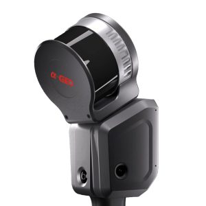
Popular Items
X200GO
The X200GO is the latest generation system based on the SLAM technology, capable of covering any customer need.
The range of up to 300 metres and a rotating head that maximises the coverage of the laser beam make it versatile for any environment. Equipped with 2 cameras and RTK receiver for real-time point cloud colouring and orientation.
The two cameras provide navigable and measurable panoramic cameras superimposed on the 3D model. The system allows for the survey of static scans in X-Whizz mode, automatically aligned to the SLAM survey.
Backpack, shoulders hook, car mount and holder for DJI M350 can complete the system.
X40GO SLAM
X40G0 is a compact system providing high-precision point cloud data, based on SLAM technology.
The 70-meters range LiDAR orientation has been designed to maximize coverage and a 12-megapixel
camera provides texture information to the 3D model.
An affordable and simple solution, the idea for interior surveys and layout generation.
Lixel K1 With 2 Batteries
Lixel K1 is a compact handheld scanning and modeling device newly
announced. With a lightweight body, it integrates 56 million-pixel
panoramic vision modules and a 360 ° LiDAR, capable of real-time
generation of centimeter-level colored 3D models. Tailored for
professionals, small to medium-sized businesses, and 3D enthusiasts,
it offers a convenient solution for 3D capture and modeling.
Pano Camera
Enhance your SLAM survey by adding important properties such as the 360° panoramic photos and visualize your point cloud with images for contextual image referencing.
X70GO SLAM Laser Scanner
X70GO is a real-time 3D model reconstruction device which integrates inertial navigation module, high performance computer and storage system. It is equipped with a 360° rotating head, which, combined with the SLAM algorithm, generates high-precision point cloud data.
Surveying equipment GNSS, 3D scanners

Latest News

DJI FLIP. Unpacking…
Hello, everyone! In this video, we take a look at the latest DJI Flip UAV – a unique and innovative unmanned aerial vehicle that promises

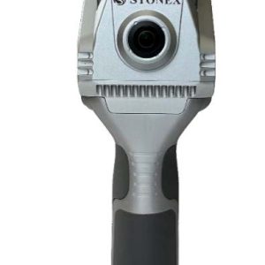
STONEX R120. Field test with Edijs.
Hello, dear viewers! Today we are going to do a practical test with the Stonex R120 Robotic Tachymeter outdoors. We will combine several features to

Stonex R120 and R180 Robotic Total Stations.
Hello everyone! Today on our YouTube channel we would like to introduce you to two great instruments from Stonex – the R120 and R180 Robotic

New from STONEX – S880 GNSS with AR camera. Familiarisation and field test.
We made a video on our YouTube channel about the Stonex S880 GNSS receiver. First we talked about the device in the studio and then