Surveyor Ultra
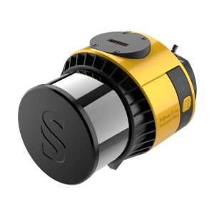
With its 360° field of view, the YellowScan Surveyor Ultra answers vertical mapping and mobile mapping needs when combined with Fly&Drive. Expect unparalleled vegetation penetration thanks to this system’s 32 laser beams.
T1000 / T1100
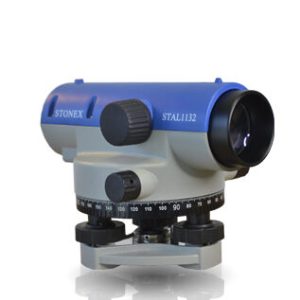
STAL 1032, with the same telescope magnifications (thanks to the high accuracy automatic air damping compensator) features higher accuracy, up to 1.0 mm/Km on a double run leveling. STAL 1132 offer minimum focusing down to 0.4 m for better performance in tight spots or on steep slopes.
Tablet Charging Equipment
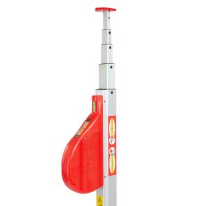
Telescopic meters
• Two indices for inner and outer dimensions.
• Horizontal and vertical bubble level for exact handling.
• Accuracy according to MID-guidelines.
• Anodized aluminium square tubes for a solid and stable stand.
• Bilateral pressure spring lock prevents the elements from slumping
down.
• All models incl. carrying bag made of sailcloth.
• The TELEFIX- telescopic meters are available at 3m, 4m, 5m, 6m, 8m
and 10m length.
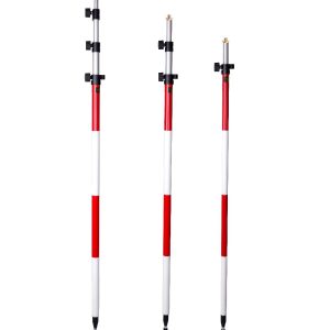
Telescopic Prism Surveying Pole
Reflector pole with red/white markings for high visibility.
Twist lock provides easy and secure tightening.
Graduated in cm and ft, min. length 1.30m, extendible to 2.15m.
Aluminium cannulation thickness: 1.5mm.
Aluminium cannulation diameter: 25mm.
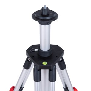
Telescopic tripod
Nr.13001000
For light rotating and line lasers. In combination with the Pythagorasadaptor,
using the telescopic tripod increases reliability and accuracy of
distance measurements with Disto-devices.
TerraMatch
TerraMatch is a sophisticated tool for improving the accuracy and quality of the raw laser point cloud. It compares laser data from overlapping flight or drive paths and calculates correction values for the misalignment angles as well as xyz location errors. The comparison and correction value calculation can be either based on surface matching or on different types of tie lines.
TerraModeler
With TerraModeler you can create, edit, and utilize surface models. TerraModeler creates surface models (TINs) from various sources, such as LiDAR points stored in binary files or loaded in TerraScan, XYZ ascii files and graphical design elements. The software offers versatile visualization options including colored shaded surfaces, contour lines, grids, colored triangle nets, elevation texts, slope directions and textured surfaces (in combination with TerraPhoto).
TerraPhoto
TerraPhoto is specifically developed for processing images captured together with laser data during a survey mission. The software enables the production of rectified images and ortho mosaics based on ground model that has been extracted from the laser data. The positioning of the source images can be refined by using tie points for image-to-image adjustment while ground control point can be involved for improving the absolute accuracy of the image block.
TerraScan
TerraScan is the main application in the Terrasolid Software family for managing and processing all types of point clouds. It offers import and project structuring tools for handling the massive number of points of a laser scanning campaign as well as the corresponding trajectory information. Various classification routines enable the automatic filtering of the point cloud.
TerraSlave
Processing massive amounts of laser points and images can be a real challenge to a single PC. With TerraSlave you can distribute time- and resource-consuming tasks such as TerraScan macro execution to several PCs over a LAN and thus, free your own workstation for other processing steps.


