

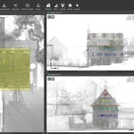
PointCab Origins is your Swiss Army Knife for the evaluation of point cloud data – no matter from which laser scanner and compatible with all CAD and BIM systems. From point cloud registration to the creation of vector lines and the transfer of your results into your CAD system, Origins offers you the perfect point cloud workflow.

PointCab Origins
In Stock
Highlights:
The point cloud software Origins:
Evaluate point clouds easily, for architects, engineers, the construction sector, and more.
Capture your environment, quickly evaluate point clouds, and share results.
SKU: N/A
Category: 3D Software
Related products
TerraScan
Highlights:
TerraScan is the main application in the Terrasolid Software family for managing and processing all types of point clouds. It offers import and project structuring tools for handling the massive number of points of a laser scanning campaign as well as the corresponding trajectory information. Various classification routines enable the automatic filtering of the point cloud.
TerraMatch
Highlights:
TerraMatch is a sophisticated tool for improving the accuracy and quality of the raw laser point cloud. It compares laser data from overlapping flight or drive paths and calculates correction values for the misalignment angles as well as xyz location errors. The comparison and correction value calculation can be either based on surface matching or on different types of tie lines.
TerraModeler
Highlights:
With TerraModeler you can create, edit, and utilize surface models. TerraModeler creates surface models (TINs) from various sources, such as LiDAR points stored in binary files or loaded in TerraScan, XYZ ascii files and graphical design elements. The software offers versatile visualization options including colored shaded surfaces, contour lines, grids, colored triangle nets, elevation texts, slope directions and textured surfaces (in combination with TerraPhoto).
TerraPhoto
Highlights:
TerraPhoto is specifically developed for processing images captured together with laser data during a survey mission. The software enables the production of rectified images and ortho mosaics based on ground model that has been extracted from the laser data. The positioning of the source images can be refined by using tie points for image-to-image adjustment while ground control point can be involved for improving the absolute accuracy of the image block.
TerraStereo
Highlights:
TerraStereo is a stand-along application for visualizing very large point clouds. It uses high-performance graphics boards for rendering huge amounts of points fast and in high quality.
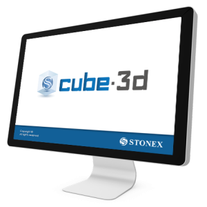
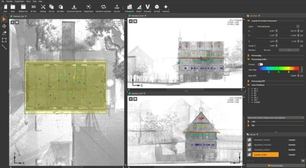
Cube-3d
Highlights:
Cube-3d is a complete software for 3D data management, built by two modules for photogrammetry and for scanner data. The former processes images (or videos) to generate accurate digital maps and 3D models with extreme precision; the latter provides tools to align point clouds.
TerraSlave
Highlights:
Processing massive amounts of laser points and images can be a real challenge to a single PC. With TerraSlave you can distribute time- and resource-consuming tasks such as TerraScan macro execution to several PCs over a LAN and thus, free your own workstation for other processing steps.