
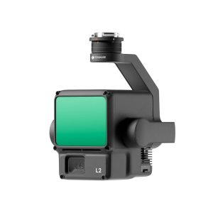
Zenmuse L2 integrates frame LiDAR, a self-developed high-accuracy IMU system, and a 4/3 CMOS RGB mapping camera, providing DJI flight platforms with more precise, efficient, and reliable geospatial data acquisition. When used with DJI Terra, it delivers a turnkey solution for 3D data collection and high-accuracy post-processing.


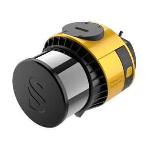
Navigator
In Stock
Highlights:
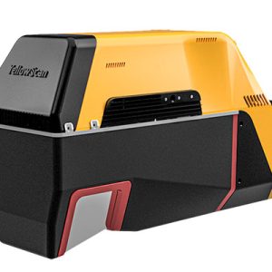
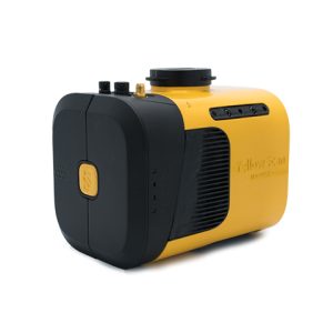
The YellowScan bathymetric LiDAR is an innovative solution for exploring underwater and ground topography with a single-button operation.
Its lightweight design allows for versatile platform selection without compromising water penetration.
Category: UAV LiDAR
Brands: Yellowscan
Related products
Fly&Drive
Highlights:
The Fly & Drive is a versatile, land vehicle or UAV-mounted, mobile mapping system that combines high-resolution laser scanning and precise positioning to collect geo-referenced pointclouds.
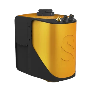
Voyager
Highlights:
The Voyager’s 100° laser scanner with its extremely fast data acquisition rate of up to 2400 kHz, makes this solution the best option for projects requiring the highest point density.
Zenmuse L2
Highlights:

Mapper+
Highlights:
The YellowScan Mapper+ is the lightest three echoes and high-density LiDAR system.
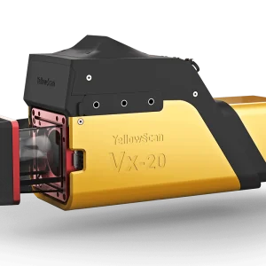
Vx20
Highlights:
The Vx20 series is the ideal solution for high-flight projects with quick data processing needs. It is the most accurate system of the Vx series.
Explorer
Highlights:
The Explorer is the first compact, versatile and long range platform on the market. It is the culmination of several years of research and development done by YellowScan, while closely working alongside customers and partners from around the world.
Surveyor Ultra
Highlights:
With its 360° field of view, the YellowScan Surveyor Ultra answers vertical mapping and mobile mapping needs when combined with Fly&Drive. Expect unparalleled vegetation penetration thanks to this system’s 32 laser beams.
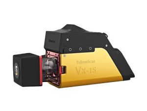
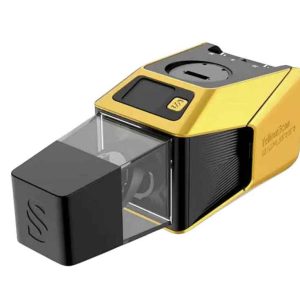
Vx15
Highlights:
Go from mapping inaccessible sites in the Balinese mountains to secluded areas in Chile.
Mapper
Highlights:
Start your LiDAR journey with Yellowscan easy-to-use Mapper system. Its low weight, mid-range capability, top-end point density and advanced accuracy and precision, makes this LiDAR system the best value for money.
Description
The YellowScan Bathymetric system is designed for conducting bathymetric measurements in shallow waters and is rapidly deployable on a UAV. This full waveform LiDAR system ensures continuity between underwater points and the surrounding terrain. Intended for aerial use on drones, the system covers various water areas such as shorelines, rivers, lakes, estuaries, ponds and gravel pits. Navigator is user-friendly and adaptable for a wide range of applications, from hydrographic surveys to underwater resource management.
Navigator
SPECIFICATION
- Laser scanner
YellowScan development
- GNSS inertial solution
SBG Quanta Micro
- Precision
3 cm
- Accuracy
3 cm
- Typ. flight speed
5 m/s
- Typ. flying height
80 m
- Max. rec. flying height
100 m
- Point density
20 pts/sqm @ 80 m AGL 5 m/s
- Laser range
Up to 120 m
- Laser wavelength
532 nm
- Scanner field-of-view
44°
- Min. Depth
0.30 m
- Max. Depth
2 Secchi
- Max. data generated
Up to 200 000 points / sec
- Echoes per shot
Up to 10 / Fullwaveform
- Shots per second
Up to 20 000
- Scanning frequency
Up to 50 Hz (selectable)
- RGB camera
Built-in 2MP global shutter
- Weight
3.7 kg (8.15 lbs) batt. excl.
- Size
L 350 x W 160 x H 190 mm
- Autonomy
40 min. typ.
- Power consumption
120 W
- Operating temperature
0° to +40 °C
- Laser class
Class 3B - Avoid direct exposure to beam
