
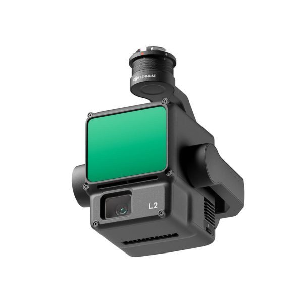
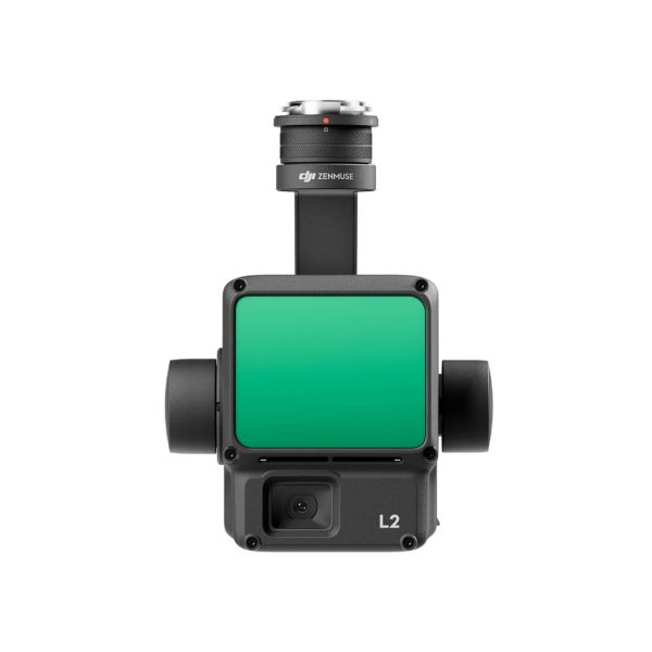
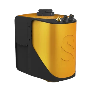
Zenmuse L2 integrates frame LiDAR, a self-developed high-accuracy IMU system, and a 4/3 CMOS RGB mapping camera, providing DJI flight platforms with more precise, efficient, and reliable geospatial data acquisition. When used with DJI Terra, it delivers a turnkey solution for 3D data collection and high-accuracy post-processing.


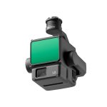
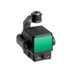

Zenmuse L2
In Stock

Highlights:
Related products
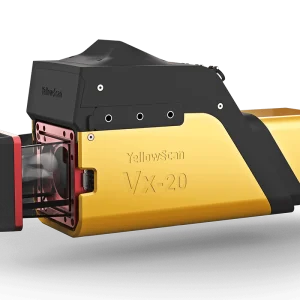
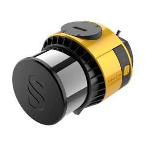
Vx20
Highlights:
The Vx20 series is the ideal solution for high-flight projects with quick data processing needs. It is the most accurate system of the Vx series.
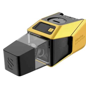
Explorer
Highlights:
The Explorer is the first compact, versatile and long range platform on the market. It is the culmination of several years of research and development done by YellowScan, while closely working alongside customers and partners from around the world.
Voyager
Highlights:
The Voyager’s 100° laser scanner with its extremely fast data acquisition rate of up to 2400 kHz, makes this solution the best option for projects requiring the highest point density.
Mapper+
Highlights:
The YellowScan Mapper+ is the lightest three echoes and high-density LiDAR system.
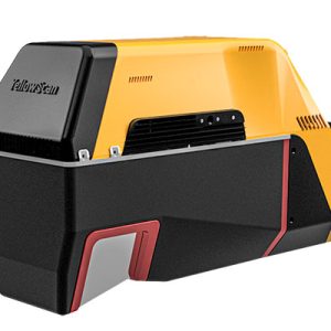
Surveyor Ultra
Highlights:
With its 360° field of view, the YellowScan Surveyor Ultra answers vertical mapping and mobile mapping needs when combined with Fly&Drive. Expect unparalleled vegetation penetration thanks to this system’s 32 laser beams.
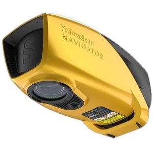
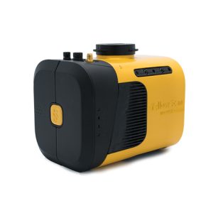
Navigator
Highlights:
The YellowScan bathymetric LiDAR is an innovative solution for exploring underwater and ground topography with a single-button operation.
Its lightweight design allows for versatile platform selection without compromising water penetration.
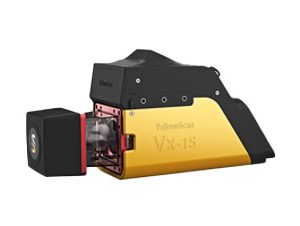
Vx15
Highlights:
Go from mapping inaccessible sites in the Balinese mountains to secluded areas in Chile.
Mapper
Highlights:
Start your LiDAR journey with Yellowscan easy-to-use Mapper system. Its low weight, mid-range capability, top-end point density and advanced accuracy and precision, makes this LiDAR system the best value for money.
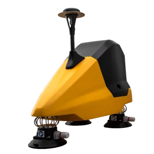
Fly&Drive
Highlights:
The Fly & Drive is a versatile, land vehicle or UAV-mounted, mobile mapping system that combines high-resolution laser scanning and precise positioning to collect geo-referenced pointclouds.
Description
Supported by its powerful hardware, L2 can allow for a precise scan of complex subjects within an extended range and faster point cloud acquisition. During operations, users can preview, playback, and process point cloud models on-site, with Task Quality Reports generated by DJI Terra, offering a simple, one-stop solution to improve overall efficiency. This enables users to achieve high-precision point cloud results with one-stop post-processing.
Zenmuse L2
SPECIFICATION
- Dimensions
155×128×176 mm (L×W×H)
- Weight
905±5 g
- Power
28 W (typical) 58 W (max.)
- IP Rating
IP54
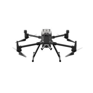
- Supported Aircraft
Matrice 300 RTK (requires DJI RC Plus)
Matrice 350 RTK
- General Operating Temperature
-20° to 50° C (-4° to 122° F)
- Storage Temperature Range
-20° to 60° C (-4° to 140° F)
System Performance
- Detection Range
450m @50% reflectivity, 0 klx
250m @10% reflectivity, 100 klx
- Point Rate
Single return: max. 240,000 pts/s
Multiple returns: max. 1,200,000 pts/s
- System Accuracy(RMS 1σ)
Horizontal: 5 cm @ 150 m
Vertical: 4 cm @ 150 m
- Real-time Point Cloud Coloring Modes
Reflectivity, Height, Distance, RGB
LiDAR
- Ranging Accuracy (RMS 1σ)
2 cm @ 150 m
- Maximum Returns Supported
5
- Scan Modes
Non-repetitive scanning pattern, Repetitive scanning pattern
- FOV
Repetitive scanning pattern: Horizontal 70°, Vertical 3°
Non-repetitive scanning pattern: Horizontal 70°, Vertical 75°
- Laser Safety
Class 1 (IEC 60825-1:2014)
- Minimum Detection Range
3 m
- Laser Wavelength
905 nm
- Laser Spot Size
Horizontal 4 cm, vertical 12 cm @ 100 m (FWHM)
- Accessible Emission Limit (AEL)
233.59 nJ
- Max Laser Pulse Emission Power Within 5 Nanoseconds
46.718 W
- Reference Aperture
Effective Aperture: 23.85 mm (equivalent to circular)
- Laser Pulse Emission Frequency
240 kHz
Inertial Navigation System
- IMU Update Frequency
200 Hz
- Accelerometer Range
±6 g
- Angular Velocity Meter Range
±300 dps
- Yaw Accuracy(RMS 1σ)
Real-time: 0.2°, Post-processing: 0.05°
- Pitch / Roll Accuracy(RMS 1σ)
Real-time: 0.05°, Post-processing: 0.025°
Gimbal
- Stabilized System
3-axis (tilt, roll, pan)
- Angular Vibration Range
0.01°
- Mount
Detachable DJI SKYPORT
- Mechanical Range
Tilt: -143° to +43°
Pan: ±105°
- Operation Modes
Follow/Free/Re-center
