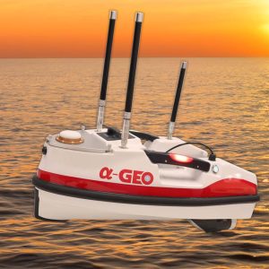
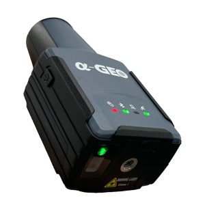
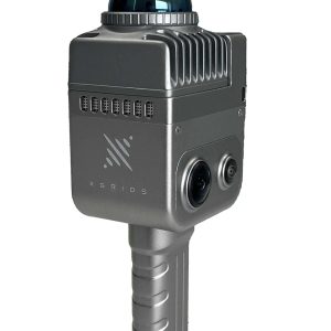
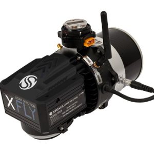
Pano Camera
SPECIFICATION
- Model
Insta360 X4
- Resolution
16.6 MPx
- Run time
135 min
- Weight
203 g


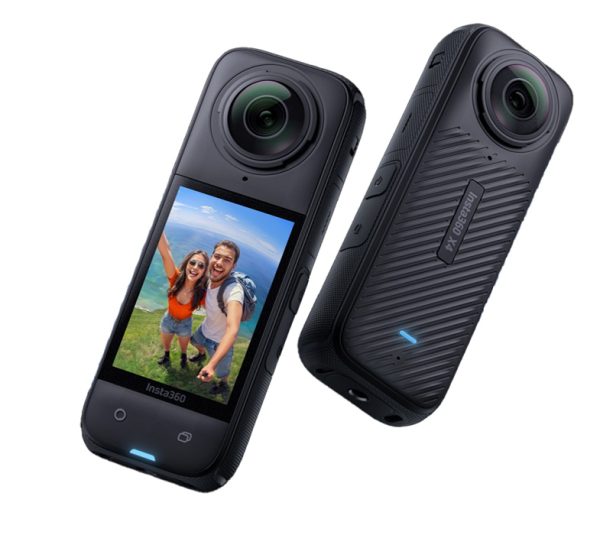
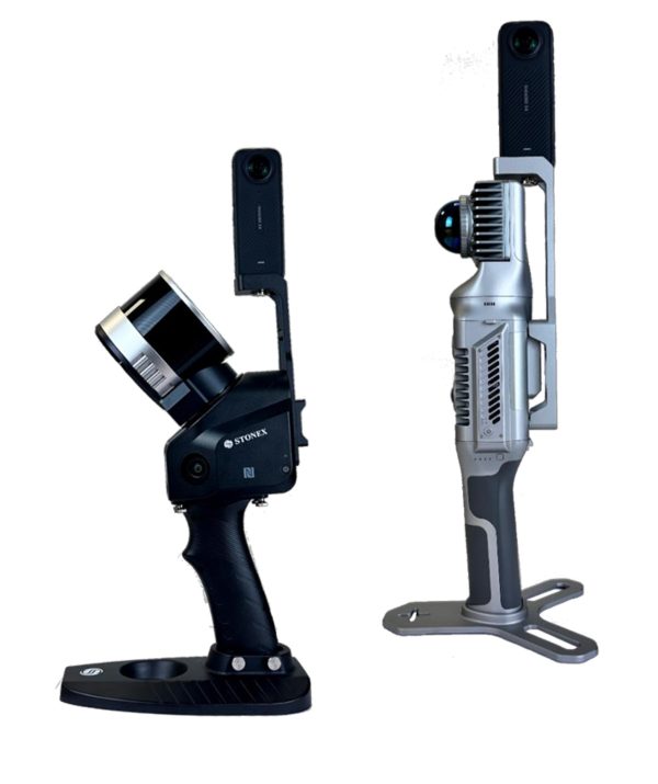
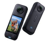
Enhance your SLAM survey by adding important properties such as the 360° panoramic photos and visualize your point cloud with images for contextual image referencing.
• Two indices for inner and outer dimensions.
• Horizontal and vertical bubble level for exact handling.
• Accuracy according to MID-guidelines.
• Anodized aluminium square tubes for a solid and stable stand.
• Bilateral pressure spring lock prevents the elements from slumping
down.
• All models incl. carrying bag made of sailcloth.
• The TELEFIX- telescopic meters are available at 3m, 4m, 5m, 6m, 8m
and 10m length.
Lixel K1 is a compact handheld scanning and modeling device newly
announced. With a lightweight body, it integrates 56 million-pixel
panoramic vision modules and a 360 ° LiDAR, capable of real-time
generation of centimeter-level colored 3D models. Tailored for
professionals, small to medium-sized businesses, and 3D enthusiasts,
it offers a convenient solution for 3D capture and modeling.
Levelling rod [Aluminum, 2 sides, 4m,4 sections, FS=10mm(E), BS=1mm
The X200GO is the latest generation system based on the SLAM technology, capable of covering any customer need.
The range of up to 300 metres and a rotating head that maximises the coverage of the laser beam make it versatile for any environment. Equipped with 2 cameras and RTK receiver for real-time point cloud colouring and orientation.
The two cameras provide navigable and measurable panoramic cameras superimposed on the 3D model. The system allows for the survey of static scans in X-Whizz mode, automatically aligned to the SLAM survey.
Backpack, shoulders hook, car mount and holder for DJI M350 can complete the system.
XFLY series integrates high performance Inertial Navigation System with camera and LiDAR for point cloud generation. Different customer’s need can be met by the choice of Hesai LiDAR XFLY120, XFLY300 or other sensors.
Easy leveling, plumbing
points, and staking out:
Zoom3D’s unique and user
friendly onboard software
comes with a full set of
features that will speed up
your interior applications.
XVS system uses a technology based on the integration of high-resolution images, inertial systems and a complex algorithm: capturing a scenario with XVS, 3D model will be generated through photogrammetric techniques.
Walking and capturing the scene in motion, a real-time interface will guide you in the data collection, suggesting the speed of your movement and if necessary returning to an area to have enough image overlapping.
Nr. 18110000
Measuring tapes are indispensable accessories for your equipment.
Measuring tape made of glass fibre – 13mm wide.
X70GO is a real-time 3D model reconstruction device which integrates inertial navigation module, high performance computer and storage system. It is equipped with a 360° rotating head, which, combined with the SLAM algorithm, generates high-precision point cloud data.
Insta360 X4
16.6 MPx
135 min
203 g
Get access to your Orders, Wishlist and Recommendations.
Your personal data will be used to support your experience throughout this website, to manage access to your account, and for other purposes described in our privacy policy.
Shopping cart is empty!